NS2573 : Maggie's Well, Greenock
taken 9 years ago, near to Braeside, Inverclyde, Scotland
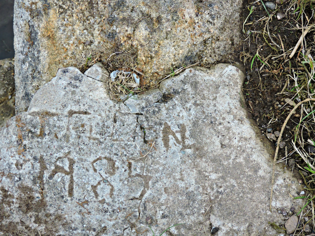
The well is near the brow of the hill (on the Greenock side), alongside the Waterman's Road, which runs between Cornalees Bridge and Overton housing scheme in Greenock.
There are at least four theories as to the origin of the well, two of which explain the name...
1. It is a well for horses and Maggie was the horse belonging to the Commanding Officer of the 6th A&SH, stationed at nearby loch Thom before being sent to France 1914/18.
2. Maggie was a shepherd who lived in a bothy during the lambing season and this was her only water supply.
3. The well was built when the Old Largs Road was the only route to Largs from Greenock by horse and cart. By the time the horses reached the brow of the hill (around 850 feet above the town) they needed a drink.
4. The Well was built to water the horses which were employed in the construction of Shaws Water Works (Loch Thom and the Greenock Cut) in the early 1800s.
Thanks to "Silver Fox" for the above information from Inverclyde Community Forum Link.
I vote for No 4.
Often confused with the Argyll & Sutherland Highlanders well which is on the same road, around a mile to the south west Link .
 Map © Crown Copyright")
- Grid Square
- NS2573, 75 images (more nearby 🔍)
- Photographer
- Thomas Nugent (more nearby)
- Date Taken
- Sunday, 30 August, 2015 (more nearby)
- Submitted
- Saturday, 5 September, 2015
- Subject Location
-
OSGB36:
 NS 2582 7398 [10m precision]
WGS84: 55:55.6351N 4:47.3673W - Camera Location
-
OSGB36: NS 2582 7398
- View Direction
- Northwest (about 315 degrees)