2015
SD6265 : Smeer Hall, Roeburndale
taken 9 years ago, near to Mill Houses, Lancashire, England
This is 1 of 2 images, with title Smeer Hall, Roeburndale in this square
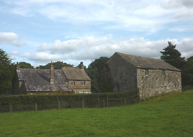
Smeer Hall, Roeburndale
A 17th/18th century farmhouse which is Grade II listed Link The footpath has been recently diverted away from this fine house (aided and abetted by Lancashire County Council). This seems to be happening more and more frequently.
 Map © Crown Copyright")
TIP: Click the map for more Large scale mapping
- Grid Square
- SD6265, 12 images (more nearby 🔍)
- Photographer
- Karl and Ali (more nearby)
- Date Taken
- Saturday, 5 September, 2015 (more nearby)
- Submitted
- Monday, 7 September, 2015
- Subject Location
-
OSGB36:
 SD 6222 6599 [10m precision]
WGS84: 54:5.3054N 2:34.7437W - Camera Location
-
OSGB36: SD 6216 6599
- View Direction
- EAST (about 90 degrees)