2015
SE1421 : Brighouse FP100, Rastrick
taken 9 years ago, near to Rastrick, Calderdale, England
This is 1 of 2 images, with title starting with Brighouse FP100 in this square
Brighouse FP100, Rastrick
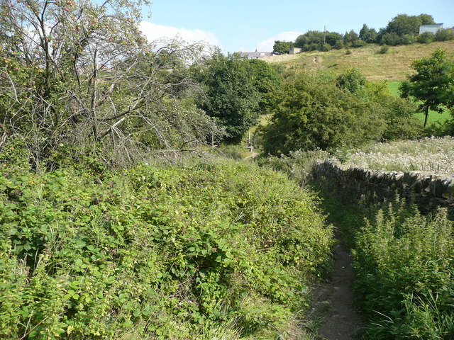
This is the path to the east of the carr Green Recreation Ground. Brambles are trying to take it over, but it is a popular path and is used enough to keep it open. A little further down there was a path on the left that connected to Quarry Lane (see SE1421 : Footpath leading to Quarry Road), but it is now completely overgrown.
 Map © Crown Copyright")
TIP: Click the map for more Large scale mapping
- Grid Square
- SE1421, 233 images (more nearby 🔍)
- Photographer
- Humphrey Bolton (more nearby)
- Date Taken
- Thursday, 10 September, 2015 (more nearby)
- Submitted
- Friday, 11 September, 2015
- Subject Location
-
OSGB36:
 SE 1404 2113 [10m precision]
WGS84: 53:41.1863N 1:47.3333W - Camera Location
-
OSGB36: SE 1404 2113
- View Direction
- EAST (about 90 degrees)