2015
TQ8170 : River Medway marker buoy, sailing boat and Kingsnorth Power Station jetty
taken 9 years ago, 3 km from Grange, Medway, England
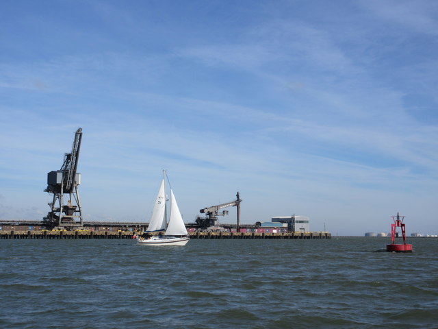
River Medway marker buoy, sailing boat and Kingsnorth Power Station jetty
A sailing boat passes by the disused power station jetty, heading towards the English Channel. It was following TQ8171 : Sailing Boat 'Azraq'.
On the right, a red marker buoy marks the southern edge of the navigable channel of the River Medway, through the mudflats.
In the far background are the large round oil storage tanks of the power station.
On the right, a red marker buoy marks the southern edge of the navigable channel of the River Medway, through the mudflats.
In the far background are the large round oil storage tanks of the power station.
River Medway
The 70 mile long river starts at Turners Hill, at the West Sussex border, and through Kent to meet the Thames Estuary. It travels through many major towns, including Tonbridge, Maidstone, Strood and Rochester. The river has many locks from Tonbridge to Allington, where the river becomes tidal. Boats can navigate the river up to Tonbridge. At Yalding there is a short diversion along the Hampstead Road Canal, whilst the river goes over sluices and below the Twyford Bridge.
After floods devastated Tonbridge in 1968 a substantial flood barrier was built in 1981 on the Medway at nearby Leigh, to protect the town.
Read more at wikipedia Link
 Map © Crown Copyright")
TIP: Click the map for more Large scale mapping
- Grid Square
- TQ8170, 2 images (more nearby 🔍)
- Photographer
- David Anstiss (more nearby)
- Date Taken
- Tuesday, 29 September, 2015 (more nearby)
- Submitted
- Friday, 2 October, 2015
- Subject Location
-
OSGB36:
 TQ 8100 7096 [10m precision]
WGS84: 51:24.5265N 0:36.0678E - Camera Location
-
OSGB36: TQ 8098 7094
- View Direction
- Northeast (about 45 degrees)