2015
NY6566 : Thirlwall Castle from track above Holmhead
taken 9 years ago, near to Greenhead, Northumberland, England
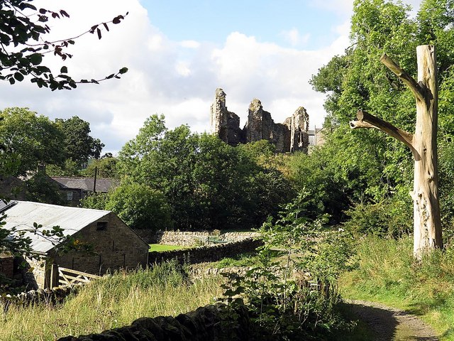
Thirlwall Castle from track above Holmhead
A mid-14th century tower keep surviving as a ruined building, largely built of stone robbed from Hadrian's Wall. It was built as a fortified stronghold above the Tipalt Burn by John Thirlwall to protect his family and their possessions from raiding Scots, particularly prevalent in the Border Raids of the 15th and 16th centuries.
Legend has it that during a particularly violent raid, the familys most prized possession, a jewel-encrusted gold table, was hidden by a servant (dwarf or troll) down a deep well where he and the table remain to this day, protected by a magic spell.
The castle has a rectangular plan with a slightly-projecting north-east tower. 2.5 to 3m thick walls standing to 2 and 3 storeys on north and west; east wall of similar height has partly collapsed at south; south wall has almost entirely collapsed.
Disused by the mid C17, the castle fell into ruin and was subjected to stone robbing, erosion by the elements and the effects of uncontrolled vegetation. Its survival was due to the massive construction and use of the Roman stones, which have long tails embedded up to 400mm (14) into the wall core. Nevertheless, by the 1990s it was in a dangerous state and major conservation works were carried out in 2000-2001 to prevent further collapses. The conservation technique known as 'soft capping' was employed to allow natural, non-woody, vegetation to protect the upper parts of the ruined walls.
Thirlwall Castle has been managed by the Northumberland National Park Authority since 1999 and is a Grade I Scheduled Monument (List Entry Number: 1006605).
The Gatehouse Gazetteer, Thirwall Castle: Link
See other images of Thirlwall Castle
 Map © Crown Copyright")
TIP: Click the map for more Large scale mapping
- Grid Square
- NY6566, 100 images (more nearby 🔍)
- Photographer
- Andrew Curtis (more nearby)
- Date Taken
- Friday, 25 September, 2015 (more nearby)
- Submitted
- Tuesday, 6 October, 2015
- Subject Location
-
OSGB36:
 NY 6594 6614 [10m precision]
WGS84: 54:59.3206N 2:32.0291W - Camera Location
-
OSGB36: NY 66018 66041
- View Direction
- Northwest (about 315 degrees)