2015
SK5317 : Benchmark on #2 Hazel Road
taken 9 years ago, near to Woodthorpe, Leicestershire, England
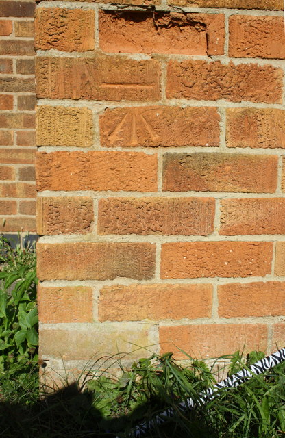
Benchmark on #2 Hazel Road
Ordnance Survey cut mark benchmark described on the Bench Mark Database at Link
 Map © Crown Copyright")
TIP: Click the map for more Large scale mapping
- Grid Square
- SK5317, 21 images (more nearby 🔍)
- Photographer
- Roger Templeman (more nearby)
- Date Taken
- Wednesday, 30 September, 2015 (more nearby)
- Submitted
- Sunday, 18 October, 2015
- Subject Location
-
OSGB36:
 SK 5328 1771 [10m precision]
WGS84: 52:45.2630N 1:12.7208W - Camera Location
-
OSGB36: SK 5328 1771
- View Direction
- NORTH (about 0 degrees)