1993
SS7049 : Cliffside path into Lynton, North Devon
taken 31 years ago, near to Lynton, Devon, England
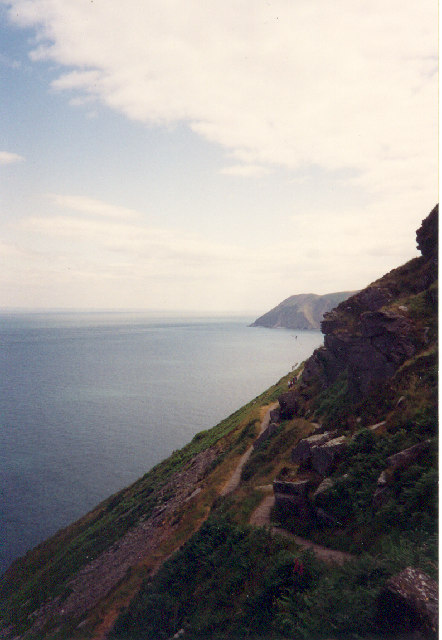
Cliffside path into Lynton, North Devon
An adventure or a nightmare, depending on your perspective. In 1993 the path was in good condition and provided extensive views and an alternative walking route, from Lee Abbey, behind the Valley of the Rocks and Hollerday Hill, compared with the road.
 Map © Crown Copyright")
TIP: Click the map for more Large scale mapping
- Grid Square
- SS7049, 250 images (more nearby 🔍)
- Photographer
- Marion Dutcher (more nearby)
- Date Taken
- June 1993 (more nearby)
- Submitted
- Thursday, 1 September, 2005
- Subject Location
-
OSGB36:
 SS 70 49 [1000m precision]
WGS84: 51:13.7971N 3:51.3666W