2015
NS9222 : M74 south of Abington
taken 8 years ago, near to Abington, South Lanarkshire, Scotland
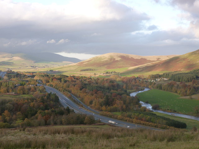
M74 south of Abington
The motorway cuts through the Colebrooke Plantation just south of Abington, with a section of the old A74 which it superseded (now the A702 at this point) visible just to the right of the motorway.
The River Clyde is on the right, with sunlight falling on White Hill and Arbory Hill on its opposite bank.
The River Clyde is on the right, with sunlight falling on White Hill and Arbory Hill on its opposite bank.
 Map © Crown Copyright")
TIP: Click the map for more Large scale mapping
- Grid Square
- NS9222, 33 images (more nearby 🔍)
- Photographer
- Alan O'Dowd (more nearby)
- Date Taken
- Saturday, 31 October, 2015 (more nearby)
- Submitted
- Monday, 2 November, 2015
- Subject Location
-
OSGB36:
 NS 9292 2256 [10m precision]
WGS84: 55:29.1047N 3:41.7627W - Camera Location
-
OSGB36: NS 9257 2177
- View Direction
- North-northeast (about 22 degrees)