SJ5486 : Fiddler's Ferry power station from the Peak District
taken 8 years ago, near to Penketh, Warrington, England
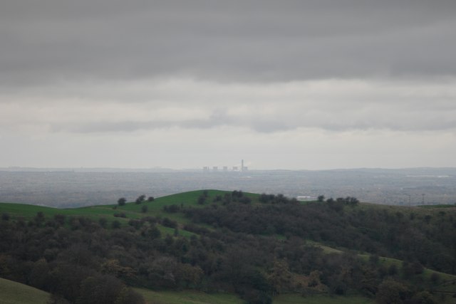
"With its eight 114-metre (374 ft) high cooling towers and 200-metre (660 ft) high chimney the station is a prominent landmark and can be seen from as far away as the Peak District and the Pennines."
It certainly can. I took this shot from an elevation of 385m just above Cessbank Common. Samsung NX500 with a 50-200 zoom lens at 200mm (equivalent to 308mm on a 35mm camera). f5.6 1/250th second ISO200. It was a very dark and gloomy day, and I tried ISO100 too but it washed out the detail.
Fiddler's Ferry Power Station is a coal fired power station located which is capable of co-firing biomass. It is situated on the north bank of the River Mersey between Widnes and Warrington. Opened in 1971, the station has a generating capacity of 1,989 megawatts (MW). The station has been operated by various companies since the privatisation of the Central Electricity Generating Board in 1990. Scottish and Southern Energy plc (SSE) has operated the station since 2004.
With its eight 114-metre (374 ft) high cooling towers and 200-metre (660 ft) high chimney Fiddlers Ferry power station is a prominent landmark and can be seen from as far away as the Peak District and the Pennines.
Abridged from Wikipedia Link
LinkSSE page about Fiddlers Ferry
 Map © Crown Copyright")
- Grid Square
- SJ5486, 50 images (more nearby 🔍)
- Photographer
- Bob Harvey (more nearby)
- Date Taken
- Wednesday, 11 November, 2015 (more nearby)
- Submitted
- Friday, 13 November, 2015
- Subject Location
-
OSGB36:
 SJ 544 863 [100m precision]
WGS84: 53:22.2949N 2:41.2095W - Camera Location
-
OSGB36: SJ 954 679
- View Direction
- West-northwest (about 292 degrees)