2015
TG2502 : RAF Stoke Holy Cross - transmitter site
taken 8 years ago, near to Upper Stoke, Norfolk, England
This is 1 of 9 images, with title RAF Stoke Holy Cross - transmitter site in this square
RAF Stoke Holy Cross - transmitter site
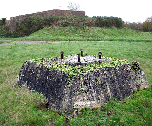
The transmitter block seen from one of the concrete plinths of tower 3. In December 2004 the earthen traverse surrounding the building was lowered in height to stop children from jumping onto the roof and the entrance doorways were bricked up.
"Chain Home" was the codename for a ring of coastal radar stations built before and during WWII. The system is otherwise known as AMES Type 1. It was devised by Sir Robert Watson-Watt's Air Ministry research station near Bawdsey, Suffolk, and consists of radar fixed on top of a radio tower mast called a 'station' to provide long-range detection of aircraft. The Chain Home stations were arranged around the British coast, initially in the South and East but later the entire coastline, including the Shetland Islands. The system was dismantled after the war, but some of the tall steel radar towers were converted to new uses > Link. Link
"Chain Home" was the codename for a ring of coastal radar stations built before and during WWII. The system is otherwise known as AMES Type 1. It was devised by Sir Robert Watson-Watt's Air Ministry research station near Bawdsey, Suffolk, and consists of radar fixed on top of a radio tower mast called a 'station' to provide long-range detection of aircraft. The Chain Home stations were arranged around the British coast, initially in the South and East but later the entire coastline, including the Shetland Islands. The system was dismantled after the war, but some of the tall steel radar towers were converted to new uses > Link. Link
 Map © Crown Copyright")
TIP: Click the map for more Large scale mapping
- Grid Square
- TG2502, 159 images (more nearby 🔍)
- Photographer
- Evelyn Simak (more nearby)
- Date Taken
- Thursday, 19 November, 2015 (more nearby)
- Submitted
- Thursday, 19 November, 2015
- Subject Location
-
OSGB36:
 TG 2581 0275 [10m precision]
WGS84: 52:34.5393N 1:19.8682E - Camera Location
-
OSGB36: TG 2580 0274
- View Direction
- Northeast (about 45 degrees)