2015
SO8557 : Nineteenth-century benchmark on gate pier
taken 8 years ago, near to Claines, Worcestershire, England
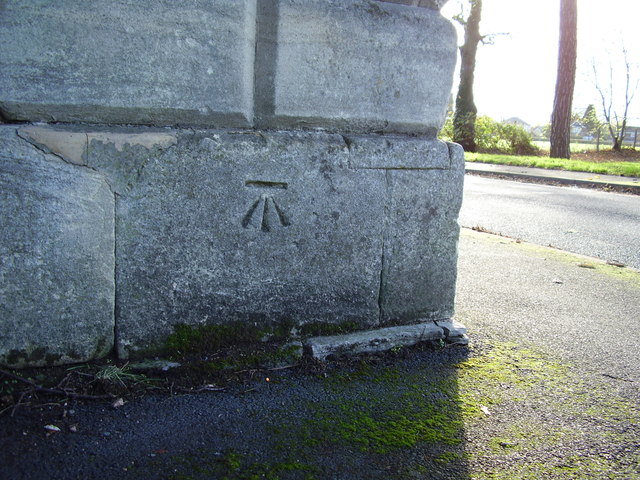
Nineteenth-century benchmark on gate pier
This benchmark was established in 1844 during the First primary levelling of England & Wales, and was levelled with a height of 95.455 feet [29.095 metres] above mean sea level (Liverpool datum). It was included on the Manchester to Gloucester levelling line. The surveyor's description was "No.380 Mark on foundation stone of gate pier to Sir Offley Wakeman's demesne, Perdswell [sic]; 1.77 ft. above centre of road" (Public Abstract p.34). The mark is clearly visible on the north-west face of the north-east gatepost at the entrance to Perdiswell Park.
 Map © Crown Copyright")
TIP: Click the map for more Large scale mapping
- Grid Square
- SO8557, 126 images (more nearby 🔍)
- Photographer
- Shantavira (more nearby)
- Date Taken
- Friday, 20 November, 2015 (more nearby)
- Submitted
- Saturday, 21 November, 2015
- Subject Location
-
OSGB36:
 SO 8502 5744 [10m precision]
WGS84: 52:12.8981N 2:13.2402W - Camera Location
-
OSGB36: SO 8502 5744
- View Direction
- Southeast (about 135 degrees)