2015
SU0333 : Path crossroads on the Monarch's Way
taken 9 years ago, near to Baverstock, Wiltshire, England
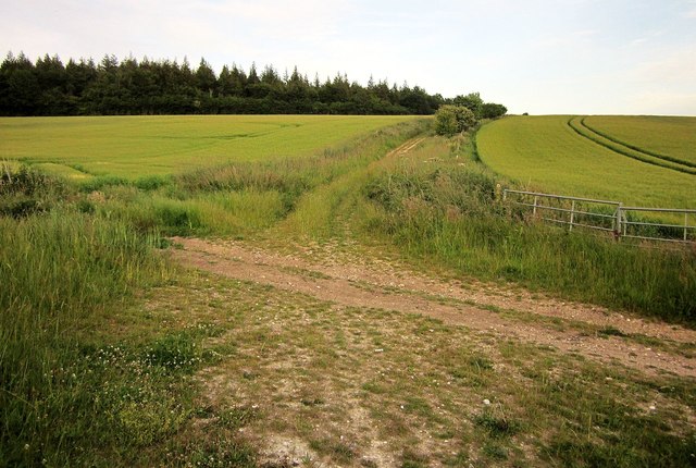
Path crossroads on the Monarch's Way
The Way turns left here, from restricted byway BSTM 4 onto BSTM 10. The Ox Drove continues ahead to Wilton. Right is for Baverstock. The plantation on the left is West Thornhills.
 Map © Crown Copyright")
TIP: Click the map for more Large scale mapping
- Grid Square
- SU0333, 18 images (more nearby 🔍)
- Photographer
- Derek Harper (more nearby)
- Date Taken
- Saturday, 27 June, 2015 (more nearby)
- Submitted
- Saturday, 21 November, 2015
- Subject Location
-
OSGB36:
 SU 0358 3318 [10m precision]
WGS84: 51:5.8749N 1:57.0151W - Camera Location
-
OSGB36: SU 0356 3318
- View Direction
- East-southeast (about 112 degrees)