2015
SX7940 : Country lane near Dunstone, Devon
taken 9 years ago, near to Dunstone, Devon, England
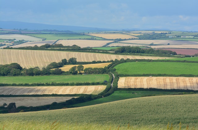
Country lane near Dunstone, Devon
...with the blue hills of Dartmoor in the distance.
 Map © Crown Copyright")
TIP: Click the map for more Large scale mapping
- Grid Square
- SX7940, 8 images (more nearby 🔍)
- Photographer
- Edmund Shaw (more nearby)
- Date Taken
- Tuesday, 15 September, 2015 (more nearby)
- Submitted
- Tuesday, 24 November, 2015
- Subject Location
-
OSGB36:
 SX 7956 4024 [10m precision]
WGS84: 50:14.9903N 3:41.4398W - Camera Location
-
OSGB36: SX 7965 4000
- View Direction
- North-northwest (about 337 degrees)