NS2875 : Greenock charcoal Works
taken 8 years ago, near to Greenock, Inverclyde, Scotland
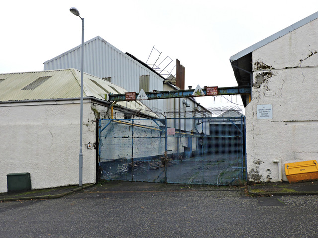
At 21 Dellingburn Street. It's difficult to tell if these premises are still in use due to their run down, but secure appearance.
Opened by John Poynter of Glasgow in 1834 to produce charcoal filters from animal bones for the many Greenock sugar refineries of that time. Later taken over by British Charcoals and Macdonalds Ltd, current owners unknown.
If you have ever been in the vicinity while charcoal is being produced you will relate to this comment by Prof. John R. Hume of RCAHMS in 1971 "The process of making animal charcoal is a malodorous one, so that visual concerns were secondary to olfactory ones".
The remains of a spur from the Glasgow to Princes Pier railway line can be seen beyond the blue gate on the Dellingburn Street side of the works. A short section of track, complete with a weighbridge for railway trucks, can be seen there.
A branch of Shaws Water Works Link runs through the premises, but is not visible from the road.
The silos were added after 1971 and are currently in a dilapidated state.
Here is a Linkto the Canmore web site pages about this site, which includes John R. Hume's photo of the same scene from 1971.
 Map © Crown Copyright")
- Grid Square
- NS2875, 810 images (more nearby 🔍)
- Photographer
- Thomas Nugent (more nearby)
- Date Taken
- Monday, 2 November, 2015 (more nearby)
- Submitted
- Sunday, 29 November, 2015
- Subject Location
-
OSGB36:
 NS 2810 7551 [10m precision]
WGS84: 55:56.5082N 4:45.2391W - Camera Location
-
OSGB36: NS 2809 7551
- View Direction
- EAST (about 90 degrees)