SO8480 : Austcliff Bridge south of Caunsall in Worcestershire
taken 9 years ago, near to Caunsall, Worcestershire, England
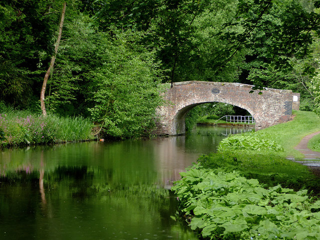
When the canals (or railways) were built in the 18th and 19th centuries, they were often routed in such a way that farmers and other landowners had their land bisected, so bridges had to be provided to allow access to fields on both sides of the canal. These bridges are frequently referred to as accommodation bridges, and however solid and well constructed, often don't lead anywhere except from one field to another.
The Staffordshire and Worcestershire Canal was opened in 1772, engineered by James Brindley. It cost a little over £100,000 at the time. It links the River Severn at Stourport to the Trent and Mersey Canal at Great Haywood Junction in Staffordshire. There are 43 locks (45 if you don't fancy the deep wide locks at Stourport) and the canal is 46 miles in length.
 Map © Crown Copyright")
- Grid Square
- SO8480, 244 images (more nearby 🔍)
- Photographer
- Roger D Kidd (more nearby)
- Date Taken
- Friday, 29 May, 2015 (more nearby)
- Submitted
- Sunday, 29 November, 2015
- Subject Location
-
OSGB36:
 SO 8493 8071 [10m precision]
WGS84: 52:25.4500N 2:13.3823W - Camera Location
-
OSGB36: SO 8499 8065
- View Direction
- Northwest (about 315 degrees)