NS7792 : Heyford Mill
taken 8 years ago, near to Cambusbarron, Stirling, Scotland
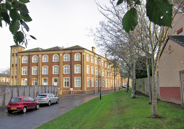
The mill spun and wove winceys, cotton and tweed. The business was established by Robert Smith Snr. in 1833, though the current buildings date from 1860 to 1880. The mill was further developed by Robert Smith Jnr, and at one stage was the largest factory in Stirlingshire, and the largest tweed manufactory under one roof in Scotland.
At its height in the 1870s, the mill employed more than 1200 people. Cotton supply difficulties, (due to the American Civil War), a large fire in 1887, and probable mis-management led to the complete closure of the mill in 1896.
Various attempts were made to revive the mill, but all proved unsuccessful. During the First World War troops were billeted there by the Army. After the War a carpet-weaving firm occupied the premises but like other previous ventures this also failed. The mill then came into the ownership of the government and was used as a storage depot.
The buildings are Category A Listed.
Starting in 2000, work began to convert the entire complex into houses and flats, and some additional blocks were erected, approximately complimenting the style of the existing industrial buildings.
Currently (November 2015) some land within the site remains to be developed or landscaped, and the Category A Listed former engine house stands as a derelict shell, and is placed at 'high risk' on the Buildings at Risk Register for Scotland.
 Map © Crown Copyright")
- Grid Square
- NS7792, 32 images (more nearby 🔍)
- Photographer
- Richard Dorrell (more nearby)
- Date Taken
- Saturday, 14 November, 2015 (more nearby)
- Submitted
- Monday, 30 November, 2015
- Subject Location
-
OSGB36:
 NS 7763 9282 [10m precision]
WGS84: 56:6.7443N 3:58.1674W - Camera Location
-
OSGB36: NS 7760 9278
- View Direction
- Northeast (about 45 degrees)