2015
SD7778 : Benchmark on barn at Ingman Lodge
taken 9 years ago, near to Ribblehead, North Yorkshire, England
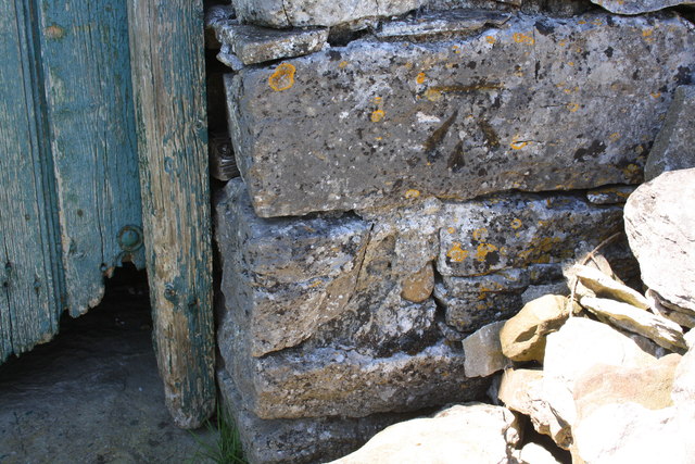
Benchmark on barn at Ingman Lodge
Ordnance Survey cut mark benchmark described on the Bench Mark Database at Link
 Map © Crown Copyright")
TIP: Click the map for more Large scale mapping
- Grid Square
- SD7778, 76 images (more nearby 🔍)
- Photographer
- Roger Templeman (more nearby)
- Date Taken
- Wednesday, 10 June, 2015 (more nearby)
- Submitted
- Wednesday, 2 December, 2015
- Subject Location
-
OSGB36:
 SD 7795 7805 [10m precision]
WGS84: 54:11.8636N 2:20.3687W - Camera Location
-
OSGB36: SD 7795 7805
- View Direction
- West-northwest (about 292 degrees)