2015
SO9540 : Parsons' Folly, Bredon Hill
taken 8 years ago, near to Great Comberton, Worcestershire, England
This is 1 of 17 images, with title Parsons' Folly, Bredon Hill in this square
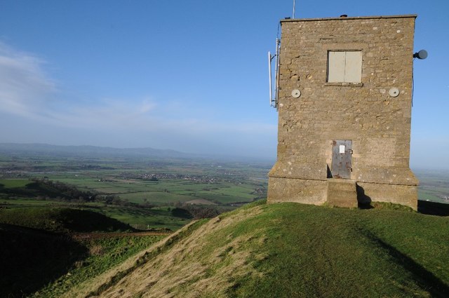
Parsons' Folly, Bredon Hill
Parsons' Folly was built as a folly in the 18th century by Mr Parsons of Kemerton, it is 39 feet high, the summit of Bredon Hill is 961 feet above sea level thus making the top of the folly exactly 1,000 feet above sea level. Spread below is the vale through which both the Avon and Severn, on the horizon are the Malvern Hills.
 Map © Crown Copyright")
TIP: Click the map for more Large scale mapping
- Grid Square
- SO9540, 200 images (more nearby 🔍)
- Photographer
- Philip Halling (more nearby)
- Date Taken
- Thursday, 31 December, 2015 (more nearby)
- Submitted
- Thursday, 31 December, 2015
- Subject Location
-
OSGB36:
 SO 9567 4017 [10m precision]
WGS84: 52:3.5935N 2:3.8741W - Camera Location
-
OSGB36: SO 9569 4016
- View Direction
- West-northwest (about 292 degrees)