2016
NZ7917 : Landslip, Rosedale Cliff
taken 8 years ago, near to Port Mulgrave, North Yorkshire, England
This is 1 of 3 images, with title Landslip, Rosedale Cliff in this square
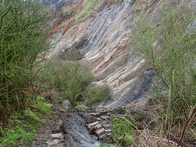
Landslip, Rosedale Cliff
Recent incessant rain over the last month has caused a landslip wiping out the footpath down to the beach. Already the locals have forged a new way down through the bracken. I worked on this section of the footpath a little over two years ago after an earlier landslip. The land is National Trust property.
See other images of Landslip, Rosedale Cliffs
See other images of Landslip, Rosedale Cliffs
 Map © Crown Copyright")
TIP: Click the map for more Large scale mapping
- Grid Square
- NZ7917, 129 images (more nearby 🔍)
- Photographer
- Mick Garratt (more nearby)
- Date Taken
- Monday, 11 January, 2016 (more nearby)
- Submitted
- Monday, 11 January, 2016
- Subject Location
-
OSGB36:
 NZ 7972 1757 [10m precision]
WGS84: 54:32.8270N 0:46.1474W - Camera Location
-
OSGB36: NZ 7968 1761
- View Direction
- Southeast (about 135 degrees)