2015
SP5406 : Entrance to 'Dorset House' from London Road, next to #60 London Road
taken 9 years ago, near to Headington, Oxfordshire, England
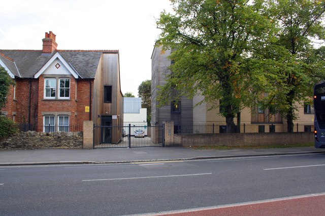
Entrance to 'Dorset House' from London Road, next to #60 London Road
Some history of buildings on this site is: Dorset House School of Occupational Therapy: 19642004. The original Dorset House (the first school of occupational therapy in the UK) was founded in Bristol in 1930 by Dr Elizabeth Casson. It moved to Oxford in 1946 and first occupied Nissen Huts in the grounds of the Churchill Hospital.
In 1961 the Dorset House Casson Trust purchased this house from Headington School, and in 1964 the Dorset House School of Occupational Therapy moved in, giving the house that had first been called Ellerslie and then Hillstow its third and final name of Dorset House. It was officially opened in 1965. In 1997 Dorset House merged with the School of Health Care Studies of Oxford Brookes University, forming the new School of Health Care. When this School moved into the former Milham Ford School on the Marston Road in 2004, Dorset House was closed and sold to property developers. It was demolished in 2009, and replacement building now provides student accommodation. Additional information can be found at Link
In 1961 the Dorset House Casson Trust purchased this house from Headington School, and in 1964 the Dorset House School of Occupational Therapy moved in, giving the house that had first been called Ellerslie and then Hillstow its third and final name of Dorset House. It was officially opened in 1965. In 1997 Dorset House merged with the School of Health Care Studies of Oxford Brookes University, forming the new School of Health Care. When this School moved into the former Milham Ford School on the Marston Road in 2004, Dorset House was closed and sold to property developers. It was demolished in 2009, and replacement building now provides student accommodation. Additional information can be found at Link
 Map © Crown Copyright")
TIP: Click the map for more Large scale mapping
- Grid Square
- SP5406, 101 images (more nearby 🔍)
- Photographer
- Roger Templeman (more nearby)
- Date Taken
- Friday, 11 September, 2015 (more nearby)
- Submitted
- Monday, 18 January, 2016
- Subject Location
-
OSGB36:
 SP 5427 0695 [10m precision]
WGS84: 51:45.5169N 1:12.9069W - Camera Location
-
OSGB36: SP 5426 0697
- View Direction
- South-southeast (about 157 degrees)