SJ5799 : Skitters Wood Sign
taken 8 years ago, near to Ashton-in-Makerfield, Wigan, England
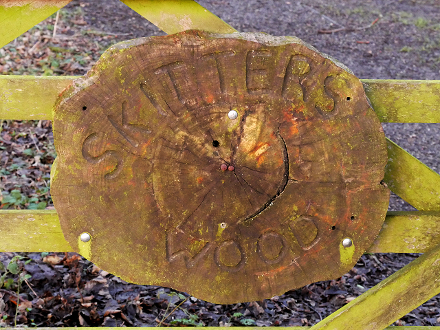
Skitters Woodland is relatively small area of ancient woodland on the western side of Ashton-in-Makerfield, which is used by the local community for walking. It has a narrow linear shape with Millingford Brook running through the centre which lies in a natural valley. Examination of old maps shows that the outline shape of Skitters Woodland has not altered since the 1800s with the exception of the removal of the lake in the 1950s and the building of the motorway straight through in the 1960s.
It was bordered to the South by Home Farm which farmed the lands up to where the natural valley dropped down to the brook. It was bordered to the North by Old Road Farm which farmed the lands up to where the natural valley dropped down to the brook. It was bordered to the East by the Town Centre. It was bordered to the West by Skitters Farm which was situated off Low Bank Road. It would appear that due to the natural valley of the line of Millingford Brook the farms which bordered the Woodland did not farm in the area around the brook which has allowed the woodland to develop unhindered. Skitters is now bordered to the North and South by the housing estates built in the 1970s on the farm land.
Skitters is a valued resource for the local community, and was noted as a priority habitat recorded as a Site of Biological Importance in Wigan Councils Local Development Framework Core Strategy Core Strategy Preferred Options Report of June 2009. The oldest trees to be found in Skitters are approximately 150 years old.
LinkFriends of Ashton
 Map © Crown Copyright")
- Grid Square
- SJ5799, 41 images (more nearby 🔍)
- Photographer
- David Dixon (more nearby)
- Date Taken
- Friday, 22 January, 2016 (more nearby)
- Submitted
- Saturday, 23 January, 2016
- Subject Location
-
OSGB36:
 SJ 5706 9936 [10m precision]
WGS84: 53:29.3513N 2:38.9180W - Camera Location
-
OSGB36: SJ 5706 9936
- View Direction
- Northeast (about 45 degrees)