2015
SE4724 : A1(M) Link Road, Holmfield Interchange
taken 9 years ago, near to Ferrybridge, Wakefield, England
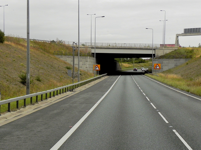
A1(M) Link Road, Holmfield Interchange
Holmfield Interchange is junction 32A of the M62 and junction 41 of the A1(M) near to Ferrybridge Power Station. It was built in 2005 to partially replace the 3 stacked roundabout Ferrybridge Interchange at Junction 33 (Link SABRE).
A1 & A1(M), Great North Road
The A1 is the longest numbered road in the UK at 410 miles long. It connects London with Edinburgh, via the east of England.
For much of its path it follows the Great North Road the old coaching route between London and Edinburgh. Several sections of the route are classified as motorway A1(M). The modern A1 bypasses the towns the Great North Road passed through and is dual carriageway for most of its route through England.
 Map © Crown Copyright")
TIP: Click the map for more Large scale mapping
- Grid Square
- SE4724, 137 images (more nearby 🔍)
- Photographer
- David Dixon (more nearby)
- Date Taken
- Sunday, 2 August, 2015 (more nearby)
- Submitted
- Saturday, 23 January, 2016
- Subject Location
-
OSGB36:
 SE 472 240 [100m precision]
WGS84: 53:42.6497N 1:17.1188W - Camera Location
-
OSGB36: SE 471 240
- View Direction
- East-southeast (about 112 degrees)