2016
NZ0593 : Viaduct on the old Northumberland Central Railway
taken 8 years ago, near to Coldrife, Northumberland, England
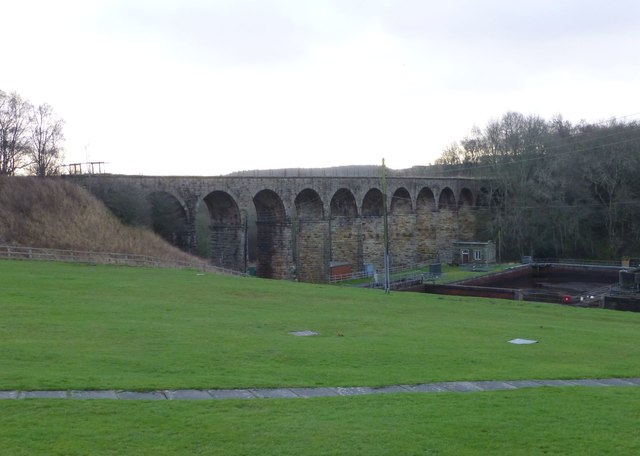
Viaduct on the old Northumberland Central Railway
Crossing the River Font below the dam retaining Fontburn Reservoir.
Northumberland Central Railway :: NZ0595
This was a single track railway which ran from Scotsgap to Rothbury. Earlier North British Railway plans had considered building the line from Kelso Branch to Scotsgap and from the North Eastern Railway's Cornhill Branch to Scotsgap.
It opened on 1 November 1870. Closure to passengers took place in September 1952. A very limited goods service continued, but the line was closed completely in October 1966.
For a map of the railway see Link
 Map © Crown Copyright")
TIP: Click the map for more Large scale mapping
- Grid Square
- NZ0593, 9 images (more nearby 🔍)
- Photographer
- Russel Wills (more nearby)
- Date Taken
- Saturday, 23 January, 2016 (more nearby)
- Submitted
- Sunday, 24 January, 2016
- Subject Location
-
OSGB36:
 NZ 0515 9374 [10m precision]
WGS84: 55:14.2702N 1:55.2335W - Camera Location
-
OSGB36: NZ 05066 93885
- View Direction
- South-southeast (about 157 degrees)