2016
SO9700 : The disused Thames and Severn Canal
taken 8 years ago, near to Coates, Gloucestershire, England
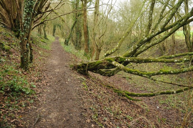
The disused Thames and Severn Canal
The towpath beside the disused Thames and Severn Canal near Thames Head and the source of the River Thames. This path is also the route of two long distance paths, the Monarch's Way and Wysis Way.
 Map © Crown Copyright")
TIP: Click the map for more Large scale mapping
- Grid Square
- SO9700, 124 images (more nearby 🔍)
- Photographer
- Philip Halling (more nearby)
- Date Taken
- Saturday, 23 January, 2016 (more nearby)
- Submitted
- Monday, 1 February, 2016
- Subject Location
-
OSGB36:
 SO 9762 0003 [10m precision]
WGS84: 51:41.9406N 2:2.1502W - Camera Location
-
OSGB36: SO 9764 0003
- View Direction
- WEST (about 270 degrees)