SK2071 : The Monsal Trail
taken 9 years ago, near to Great Longstone, Derbyshire, England
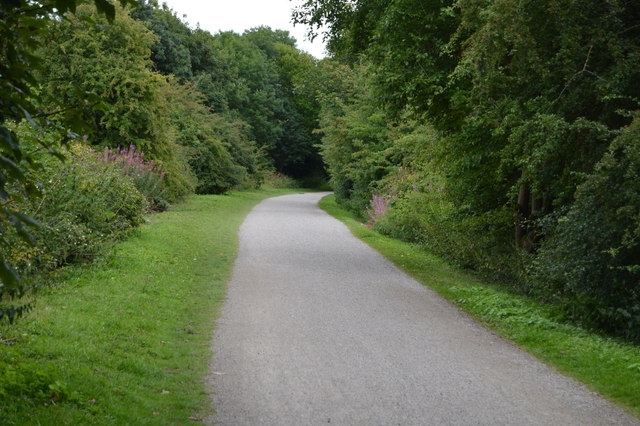
The Monsal Trail is a traffic free route for walkers, cyclists, horse riders and wheelchair users through some of the Peak District's most spectacular limestone dales.
The trail runs along the former Midland Railway line ( Link), which closed in 1968, for 8.5 miles between Blackwell Mill SK1172 : The start of The Monsal Trail, in Chee Dale and Coombs Road, at Bakewell.
Most of the route was opened to the public in 1981 but four former railway tunnels had to remain closed due to safety reasons, with public footpaths taking people around them. In 2011 the four railway tunnels - Headstone Tunnel, Cressbrook Tunnel, Litton Tunnel, Chee Tor Tunnel were opened for trail users. Each tunnel is about 400 metres long and will be lit during normal daylight hours.
Wikipedia: Link
The Manchester, Buxton, Matlock and Midland Junction Railway ran from a junction with the Midland Railway at Ambergate to Rowsley north of Matlock and on to Buxton.
It would become part of the Midland Railway's main line between London and Manchester, but it was initially planned as a route from Manchester to the East of England, via the proposed Ambergate, Nottingham, Boston and Eastern Junction Railway which would meet it a little further north along the North Midland line at Ambergate. The line opened to Rowsley in 1849 and finally reached Buxton in 1863. The line closed in 1968. part of the line is used today as The Monsal Trail.
Wikipedia: Link
 Map © Crown Copyright")
- Grid Square
- SK2071, 144 images (more nearby 🔍)
- Photographer
- N Chadwick (more nearby)
- Date Taken
- Saturday, 29 August, 2015 (more nearby)
- Submitted
- Wednesday, 3 February, 2016
- Subject Location
-
OSGB36:
 SK 2022 7113 [10m precision]
WGS84: 53:14.2092N 1:41.9107W - Camera Location
-
OSGB36: SK 2019 7113
- View Direction
- EAST (about 90 degrees)