2016
NS4274 : Cycle path at Milton
taken 8 years ago, near to Milton, West Dunbartonshire, Scotland
Cycle path at Milton
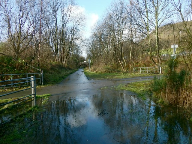
The railway line is on an embankment that is parallel to, and to the left (south) of the cycle path. As shown in the picture, another path cuts across the cycle route here: to the left, it leads, by means of an underpass, below the railway line (NS4274 : Path to the shore); to the right, it leads to the main road (A82): NS4274 : The Crags Circular Path at Milton.
The crossing of the two paths is shown, from the other side, in NS4274 : Cycle path near Dumbarton and NS4274 : Old railway line at Milton. In the present picture, the bridge visible ahead is the one that is shown in NS4274 : Road bridge at Dumbuck and (looking back from there) in NS4274 : Under the road bridge.
There is water in the foreground because the picture was taken from the flooded area that is shown in NS4274 : Flooded cycle path. Right of centre, through the trees, looms the shape of NS4274 : Dumbuck Quarry.
National Cycle Network Route 7 :: NX7662
The Lochs and Glens (North) route covers 214 miles from Inverness to Glasgow. The Lochs and Glens (South) covers 193 miles from Glasgow to Carlisle via the Ayrshire coast, Kirkcudbright and Dumfries. It continues east as the Coast to Coast C2C route to Sunderland.
 Map © Crown Copyright")
TIP: Click the map for more Large scale mapping
- Grid Square
- NS4274, 129 images (more nearby 🔍)
- Photographer
- Lairich Rig (more nearby)
- Date Taken
- Friday, 29 January, 2016 (more nearby)
- Submitted
- Thursday, 18 February, 2016
- Subject Location
-
OSGB36:
 NS 4233 7414 [10m precision]
WGS84: 55:56.0631N 4:31.5359W - Camera Location
-
OSGB36: NS 4234 7414
- View Direction
- West-northwest (about 292 degrees)