2016
SO9394 : Anchor Bridge near Deepfields, Coseley
taken 8 years ago, near to Coseley, Dudley, England
This is 1 of 3 images, with title Anchor Bridge near Deepfields, Coseley in this square
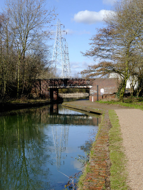
Anchor Bridge near Deepfields, Coseley
Anchor Bridge is now pedestrian only, and can be found at Deepfields Junction where the Birmingham Canal Navigation to Wolverhampton branches off (beyond the bridge) to Bradley along the Wednesbury Oak Loop. (This was Brindley's original route built in 1770. Beyond Bradley the canal was filled in and built over from the 1950s on).
The stretch of canal shown in this image is part of Thomas Telford's re-routing of the canal.
The stretch of canal shown in this image is part of Thomas Telford's re-routing of the canal.
 Map © Crown Copyright")
TIP: Click the map for more Large scale mapping
- Grid Square
- SO9394, 193 images (more nearby 🔍)
- Photographer
- Roger D Kidd (more nearby)
- Date Taken
- Thursday, 25 February, 2016 (more nearby)
- Submitted
- Monday, 29 February, 2016
- Subject Location
-
OSGB36:
 SO 9397 9494 [10m precision]
WGS84: 52:33.1362N 2:5.4218W - Camera Location
-
OSGB36: SO 9399 9487
- View Direction
- North-northwest (about 337 degrees)