2016
ST6961 : Conygre Brook valley
taken 8 years ago, near to Priston, Bath And North East Somerset, England
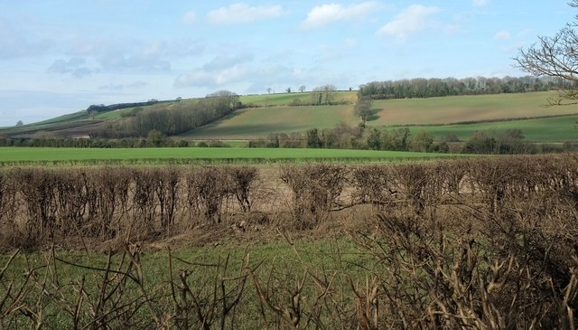
Conygre Brook valley
A view from the stretch of Mill Lane shown in ST6961 : Mill Lane, Priston, looking left across fields. Pendown Hill rises beyond the valley. The wood, Pottern Brake, is in ST6861.
 Map © Crown Copyright")
TIP: Click the map for more Large scale mapping
- Grid Square
- ST6961, 28 images (more nearby 🔍)
- Photographer
- Derek Harper (more nearby)
- Date Taken
- Tuesday, 16 February, 2016 (more nearby)
- Submitted
- Friday, 4 March, 2016
- Subject Location
-
OSGB36:
 ST 690 612 [100m precision]
WGS84: 51:20.9416N 2:26.7906W - Camera Location
-
OSGB36: ST 6927 6104
- View Direction
- Northwest (about 315 degrees)