2016
TA0929 : Beverley Road junction, Hull
taken 8 years ago, near to Kingston Upon Hull, England
This is 1 of 2 images, with title Beverley Road junction, Hull in this square
Beverley Road junction, Hull
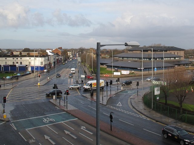
A major road junction, where Beverley Road (right) becomes Ferens Way as it heads into the city centre, crossing Spring Bank (ahead) which becomes the relatively new Freetown Way (A165) inner ring road in the foreground. Viewed from a bedroom of the Travelodge hotel TA0929 : Hotel Campanile, Hull.
 Map © Crown Copyright")
TIP: Click the map for more Large scale mapping
- Grid Square
- TA0929, 1761 images (more nearby 🔍)
- Photographer
- Stephen Craven (more nearby)
- Date Taken
- Saturday, 5 March, 2016 (more nearby)
- Submitted
- Sunday, 6 March, 2016
- Subject Location
-
OSGB36:
 TA 0910 2929 [10m precision]
WGS84: 53:44.9143N 0:20.8214W - Camera Location
-
OSGB36: TA 0917 2927
- View Direction
- West-northwest (about 292 degrees)