1993
TQ3565 : Demolition of John Ruskin School, Upper Shirley Road, Croydon
taken 31 years ago, near to Addington, Croydon, England
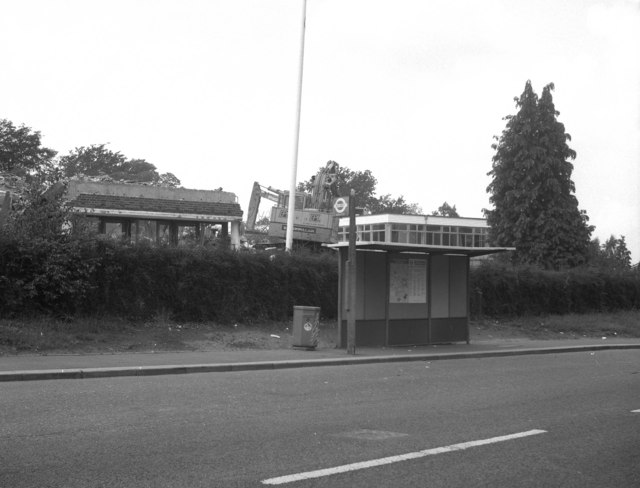
Demolition of John Ruskin School, Upper Shirley Road, Croydon
These school buildings had a very short life. Newly opened in 1954, they then housed a boys' grammar school. This eventually became co-educational and then part of a sixth form college. But the Council decided it could make more money by tearing down the less than fifty year old buildings and selling the land for housing, so in 1993 they were demolished, as seen here.
 Map © Crown Copyright")
TIP: Click the map for more Large scale mapping
- Grid Square
- TQ3565, 121 images (more nearby 🔍)
- Photographer
- Dr Neil Clifton (more nearby)
- Date Taken
- Monday, 26 July, 1993 (more nearby)
- Submitted
- Thursday, 5 July, 2007
- Subject Location
-
OSGB36:
 TQ 354 651 [100m precision]
WGS84: 51:22.1499N 0:3.2990W - Camera Location
-
OSGB36: TQ 355 651
- View Direction
- West-southwest (about 247 degrees)