2016
SD6911 : Heraldic Panel, Smithills Hall Withdrawing Room
taken 8 years ago, 3 km from Toppings, Bolton, England
This is 1 of 2 images, with title starting with Heraldic Panel, Smithills Hall in this square
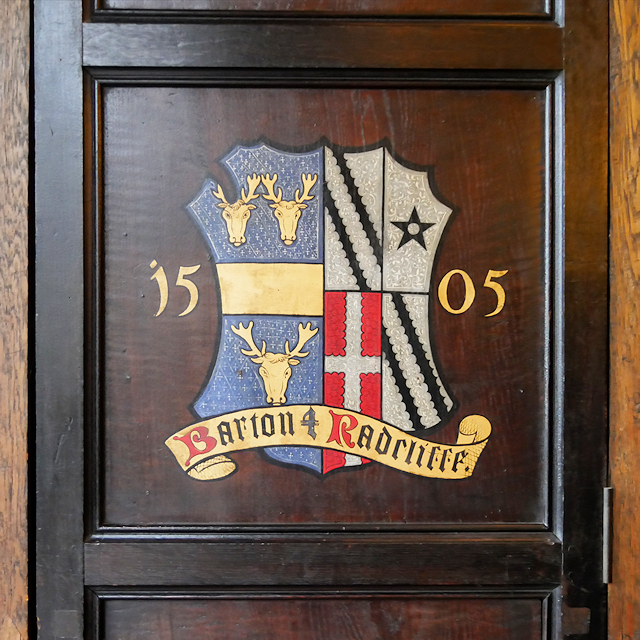
Heraldic Panel, Smithills Hall Withdrawing Room
Coloured panels, near the window, were commissioned in 1831. They show the coats of arms of arms of all the families who had lived in the hall.
Smithills Hall
Smithills Hall is a manor house, standing on the slopes of the moors above, two miles north west of the town centre. It is one of the oldest manor houses in the north west of England; its oldest parts, including the great hall, date from the 15th century and it has been since been altered and extended particularly the west part.
The hall is owned by Bolton Metropolitan Borough Council . The oldest parts were opened to the public as a museum in 1963, and in the 1990s, the museum was extended into some of the Victorian extensions. The west wing was restored by the council in 1999. It is Grade I-listed (List Entry Number: 1388279 LinkHeritage Gateway)
Link
 Map © Crown Copyright")
TIP: Click the map for more Large scale mapping
- Grid Square
- SD6911, 118 images (more nearby 🔍)
- Photographer
- David Dixon (more nearby)
- Date Taken
- Wednesday, 9 March, 2016 (more nearby)
- Submitted
- Monday, 14 March, 2016
- Subject Location
-
OSGB36:
 SD 699 118 [100m precision]
WGS84: 53:36.1516N 2:27.3075W - Camera Location
-
OSGB36: SD 699 118
- View Direction
- SOUTH (about 180 degrees)