2016
NS4377 : Mound crossed by old track
taken 8 years ago, 3 km from Milton, West Dunbartonshire, Scotland
This is 1 of 2 images, with title Mound crossed by old track in this square
Mound crossed by old track
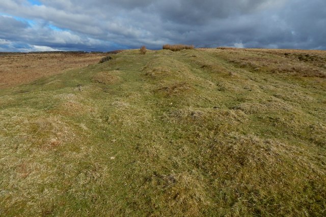
Satellite imagery with a low sun shows a large green mound here, round like a boss, with a green continuation (shown in NS4377 : Dry-stone wall) heading off in a direction between NE and ENE, through the corner of the dry-stone wall at NS43567793, and leading eventually to the western side of Little White Hill, at about NS43867813. The photograph is a view in that direction.
An NS4377 : Old braided track, approaches this mound from the WSW, and crosses it; the grooves that can be seen in the present picture are the separate strands of that track, and they recede directly from the photographer's position; the track branches at various places, but some strands reach the area shown in NS4378 : Southern side of Little White Hill.
See also NS4377 : Mound crossed by old track, which shows the same area is in the present picture, but viewed in the opposite direction.
The green colour suggests that the area is rich in limestone. Some outcrops are visible just a few metres from the spot from which the present picture was taken: NS4377 : Limestone outcrops. There are also some old quarry pits only about 80 metres to the north of this mound: NS4377 : Old quarry pit / NS4377 : Old quarry pit.
Network of old limestone industry tracks :: NS4379
A very extensive network of ancient tracks on the moors in West Dunbartonshire links old quarries, ruined lime-kilns, and other sites connected with the local limestone-burning industry, which flourished in the 18th century. See Link for a Geograph article about the network, and Link
for an annotated satellite view of it.
 Map © Crown Copyright")
TIP: Click the map for more Large scale mapping
- Grid Square
- NS4377, 146 images (more nearby 🔍)
- Photographer
- Lairich Rig (more nearby)
- Date Taken
- Friday, 4 March, 2016 (more nearby)
- Submitted
- Tuesday, 22 March, 2016
- Subject Location
-
OSGB36:
 NS 4342 7782 [10m precision]
WGS84: 55:58.0664N 4:30.6183W - Camera Location
-
OSGB36: NS 4341 7782
- View Direction
- East-northeast (about 67 degrees)