2016
NS5575 : Tannoch Loch
taken 8 years ago, near to Milngavie, East Dunbartonshire, Scotland
This is 1 of 23 images, with title Tannoch Loch in this square
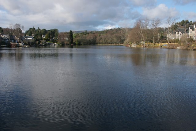
Tannoch Loch
The loch dates from 1895, when a dam was built to hold back the Tannoch Burn, and create a shallow body of water. This then provided a steady supply of water to power a small hydro-electric scheme in Milngavie. See Link
 Map © Crown Copyright")
TIP: Click the map for more Large scale mapping
- Grid Square
- NS5575, 240 images (more nearby 🔍)
- Photographer
- Richard Sutcliffe (more nearby)
- Date Taken
- Monday, 28 March, 2016 (more nearby)
- Submitted
- Wednesday, 30 March, 2016
- Subject Location
-
OSGB36:
 NS 555 753 [100m precision]
WGS84: 55:56.9363N 4:18.9356W - Camera Location
-
OSGB36: NS 5556 7518
- View Direction
- NORTH (about 0 degrees)