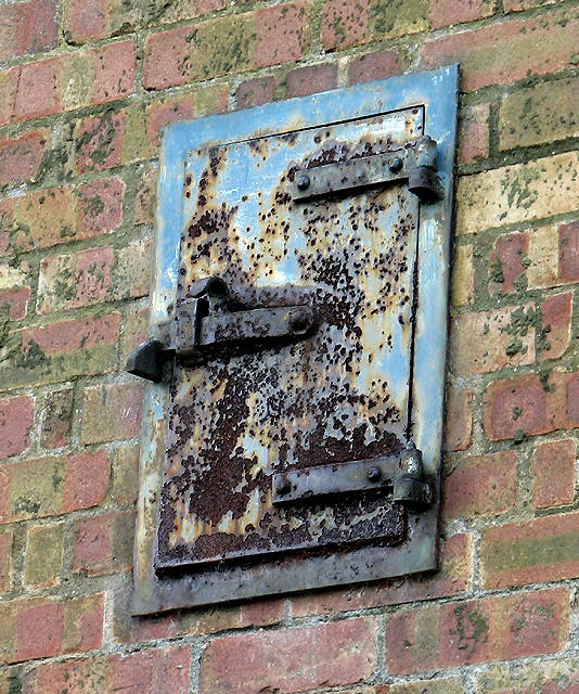
TG3420 : Flue opening
taken 8 years ago, near to Neatishead, Norfolk, England
This is a rare surviving and Grade II listed example of an early 1950s Rotor period radar standby generator house.
According to the listing text this standby generator house which used to serve RAF Neatishead is a brick-built structure consisting of a rectangular, double height generator hall with a tower attached to one end. The pantiled roofs over the hall and tower are steeply pitched, with the main roof sweeping down to form a catslide over a small porch like projection at one corner. The main entrance with access to the generator hall was through high double doors adjacent to a projecting brick flue. On the other side of the flue the two-storey belfry-like tower adjoins. It has a pair of wooden planked doors on the ground floor and a large opening with double doors higher up. At the gable end a row of four air-tile vents can be seen and further openings, all providing ventilation to the generator hall, are set into the side walls. Massive reinforced concrete beams supporting a gantry crane complete with lifting tackle divided the generator hall into four bays. The roof above is described as being of a simple coupled rafter construction. The generator and transformers have long since been removed, after which time the building was used for farm storage. (Source: Cocroft, W D & Thomas, R J C, Cold War. Building for Nuclear Confrontation 1946-1989, English Heritage).
The RRH (Remote Radar Head) Neatishead is the worlds longest continuously operating radar site and still an active radar station, providing radar, ground-to-air radio and data links coverage as part of the UK Air Surveillance And Control System (ASACS), in support of national and NATO air defence > Link. The adjoining RAF Radar Air Defence Museum > Link which is housed in one of the now obsolete buildings provides a unique window into the history of radar.
 Map © Crown Copyright")
- Grid Square
- TG3420, 32 images (more nearby 🔍)
- Photographer
- Evelyn Simak (more nearby)
- Date Taken
- April 2016 (more nearby)
- Submitted
- Wednesday, 6 April, 2016
- Subject Location
-
OSGB36:
 TG 3435 2006 [10m precision]
WGS84: 52:43.6424N 1:28.1528E - Camera Location
-
OSGB36: TG 3437 2008
- View Direction
- Southwest (about 225 degrees)