2016

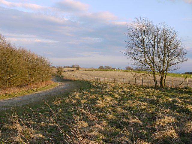
TQ1411 : The South Downs Way heading south-east from Chanctonbury Ring

taken 8 years ago, 3 km from Washington, West Sussex, England

The South Downs Way heading south-east from Chanctonbury Ring
The track runs between the densely wooded scarp slope of the Downs (on the left) and fenced arable land. In early April the scene (at an elevation of 700 feet or more) is still rather wintry, but a spring-sown cereal crop is just beginning to show green against the chalky soil.

Creative Commons Licence [Some Rights Reserved]   © Copyright Stefan Czapski and licensed for reuse under this Creative Commons Licence.
This photo is linked from: Automatic Clusters: · Arable Land [4] · Densely Wooded [2] Title Clusters: · The South Downs Way heading south-east from Chanctonbury Ring [2] ·
1:50,000 Modern Day Landranger(TM) Map © Crown Copyright
+
+
1:50,000 Modern Day Landranger(TM) Map © Crown Copyright
TIP: Click the map for more Large scale mapping
Grid Square
TQ1411, 72 images   (more nearby 🔍)
Photographer
Stefan Czapski   (more nearby)
Date Taken
Tuesday, 5 April, 2016   (more nearby)
Submitted
Thursday, 7 April, 2016
Subject Location
OSGB36: geotagged! TQ 1434 1149 [10m precision]
WGS84: 50:53.4952N 0:22.5407W
Camera Location
OSGB36: geotagged! TQ 1430 1158
View Direction
South-southeast (about 157 degrees)
Clickable map
+
NW N NE
W Go E
SW S SE
Image classification(about): Geograph
This page has been viewed about 44 times
You are not logged in login | register