2016
TQ1913 : Crabs Field/Rye Field (1)
taken 8 years ago, near to Small Dole, West Sussex, England
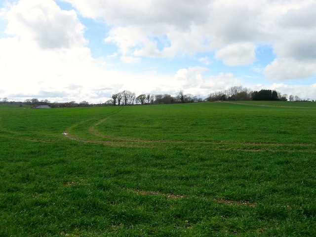
Crabs Field/Rye Field (1)
The name of the fields according to Steyning's 1840 tithe map that have been merged to form a larger unit. They are bounded by Wykeham Lane to the west, the bridleway containing the Downs Link to the north and the former Horsham-Christ's Hospital railway to the east. The roof of Wyckham Farm can also be seen on the left. See TQ1913 : Crabs Field/Rye Field (2) for a view from the south.
 Map © Crown Copyright")
TIP: Click the map for more Large scale mapping
- Grid Square
- TQ1913, 85 images (more nearby 🔍)
- Photographer
- Simon Carey (more nearby)
- Date Taken
- Saturday, 9 April, 2016 (more nearby)
- Submitted
- Sunday, 10 April, 2016
- Subject Location
-
OSGB36:
 TQ 1922 1313 [10m precision]
WGS84: 50:54.3205N 0:18.3475W - Camera Location
-
OSGB36: TQ 1948 1312
- View Direction
- WEST (about 270 degrees)