TR2741 : St Radigund's Abbey Farm
taken 8 years ago, near to West Hougham, Kent, England
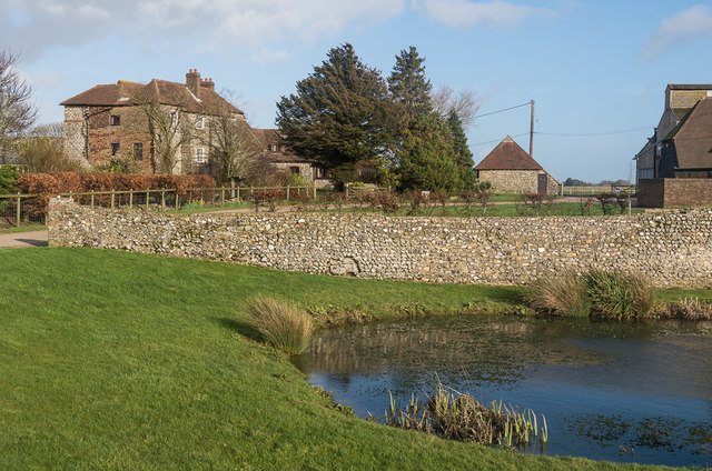
St Radegunds Abbey was founded in 1193 and was inhabited by canons from the Premonstratensian order, which had been founded in 1120 in Prémontré in northern France. The canons of this order were known as white canons because of their habits.
The abbey survived until dissolution in 1538. Stone from some of the buildings was then used to build Sandgate Abbey, with some also used for Walmer Castle and other local buildings. In 1590 Elizabeth I sold the site to a Simon Eldoph who converted the refractory to the current farmhouse. Otherwise only the gatehouse and parts of some walls survive, together with the well house and a couple of barns, although the general outline of the site is identifiable. Although largely ruined, John Newman in the North East and East Kent Pevsner guide describes it as the most extensive monastic remains in Kent, apart from Canterbury and Rochester cathedrals.
It is now a working farm (known as St Radigunds Abbey Farm), also providing self catering accommodation.
The whole site is a scheduled monument (see Linkwith the gatehouse and other extant ruins, the farmhouse and one of the barns being individually grade II* listed and the well house and another barn being grade II listed.
 Map © Crown Copyright")
- Grid Square
- TR2741, 57 images (more nearby 🔍)
- Photographer
- Ian Capper (more nearby)
- Date Taken
- Sunday, 7 February, 2016 (more nearby)
- Submitted
- Monday, 11 April, 2016
- Subject Location
-
OSGB36:
 TR 274 419 [100m precision]
WGS84: 51:7.8732N 1:14.9917E - Camera Location
-
OSGB36: TR 274 418
- View Direction
- Northeast (about 45 degrees)