2016
SJ2275 : Site of Bagillt Railway Station
taken 8 years ago, near to Bagillt, Flintshire/Sir y Fflint, Wales
This is 1 of 2 images, with title Site of Bagillt Railway Station in this square
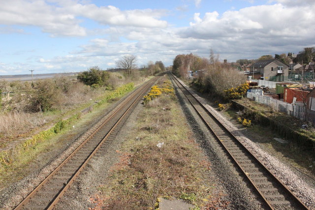
Site of Bagillt Railway Station
Looking south-east from the footbridge along the North Wales Coast Line where Bagillt railway station once stood. The station opened in 1849 and closed in 1966 as part of the Beeching Report economies.
Wikipedia Link
Wikipedia Link
 Map © Crown Copyright")
TIP: Click the map for more Large scale mapping
- Grid Square
- SJ2275, 73 images (more nearby 🔍)
- Photographer
- Jeff Buck (more nearby)
- Date Taken
- Tuesday, 5 April, 2016 (more nearby)
- Submitted
- Sunday, 17 April, 2016
- Subject Location
-
OSGB36:
 SJ 2217 7537 [10m precision]
WGS84: 53:16.1751N 3:10.1077W - Camera Location
-
OSGB36: SJ 2215 7539
- View Direction
- Southeast (about 135 degrees)