2016
SN7377 : A Curve on the Vale of Rheidol Railway, near to Devil's Bridge
taken 8 years ago, near to Devil's Bridge, Ceredigion/Sir Ceredigion, Wales
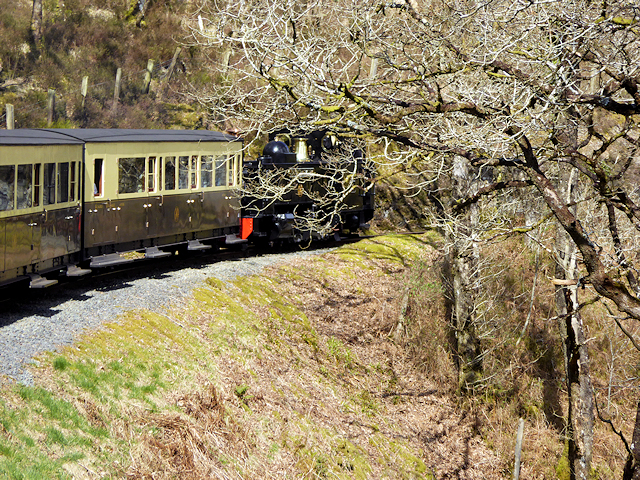
A Curve on the Vale of Rheidol Railway, near to Devil's Bridge
The Vale of Rheidol Railway (Rheilffordd Cwm Rheidol) is a 1 ft 11 ¾ in narrow gauge heritage railway that runs for 11 ¾ miles between the coast at Aberystwyth and Devil's Bridge in the Cambrian Mountains.
The line opened in 1902 to carry lead ore, timber and passenger traffic. At the time of building, it was of the most up to date standard of narrow gauge construction, and passed through terrain where it would have been almost impossible to build a standard gauge line without prohibitive costs. The narrow track gauge allows the railway to follow the contours of the hillside with many sharp curves and steep gradients which add to the railway's charm.
At the height of the lines prosperity, in 1912, consideration was given to converting the line to electric traction, using hydro-electric power from the River Rheidol. However, control of the line passed to the Cambrian Railways in the same year and plans were shelved. Following the Great War, a decline in mine traffic was balanced somewhat by a growing tourist trade. In 1923 Cambrian Railways were themselves absorbed by the Great Western Railway and goods services were withdrawn completely, and the harbour branch at Aberystwyth closed. The winter passenger service was withdrawn in 1930, and the line closed completely from the end of the 1939 summer service for the duration of the Second World War. Ownership of the line passed to British Railways in 1948, and it survived through threats of closure to become the last sole steam-operated railway operated by British Rail; steam traction having ceased in 1968 on all other parts of the network.
The railway is now owned by a charitable trust. The locomotives and carriages currently in use were built for the line by the Great Western Railway between 1923 and 1938.
Link Vale of Rheidol railway website
See other images of The Vale of Rheidol Railway (Rheilffordd Cwm Rheidol)
The line opened in 1902 to carry lead ore, timber and passenger traffic. At the time of building, it was of the most up to date standard of narrow gauge construction, and passed through terrain where it would have been almost impossible to build a standard gauge line without prohibitive costs. The narrow track gauge allows the railway to follow the contours of the hillside with many sharp curves and steep gradients which add to the railway's charm.
At the height of the lines prosperity, in 1912, consideration was given to converting the line to electric traction, using hydro-electric power from the River Rheidol. However, control of the line passed to the Cambrian Railways in the same year and plans were shelved. Following the Great War, a decline in mine traffic was balanced somewhat by a growing tourist trade. In 1923 Cambrian Railways were themselves absorbed by the Great Western Railway and goods services were withdrawn completely, and the harbour branch at Aberystwyth closed. The winter passenger service was withdrawn in 1930, and the line closed completely from the end of the 1939 summer service for the duration of the Second World War. Ownership of the line passed to British Railways in 1948, and it survived through threats of closure to become the last sole steam-operated railway operated by British Rail; steam traction having ceased in 1968 on all other parts of the network.
The railway is now owned by a charitable trust. The locomotives and carriages currently in use were built for the line by the Great Western Railway between 1923 and 1938.
Link
See other images of The Vale of Rheidol Railway (Rheilffordd Cwm Rheidol)
 Map © Crown Copyright")
TIP: Click the map for more Large scale mapping
- Grid Square
- SN7377, 659 images (more nearby 🔍)
- Photographer
- David Dixon (more nearby)
- Date Taken
- Wednesday, 13 April, 2016 (more nearby)
- Submitted
- Monday, 18 April, 2016
- Subject Location
-
OSGB36:
 SN 735 771 [100m precision]
WGS84: 52:22.6857N 3:51.5889W - Camera Location
-
OSGB36: SN 735 771
- View Direction
- West-northwest (about 292 degrees)