2016
J4972 : Pillbox, Newtownards
taken 8 years ago, near to Newtownards, Co Down, Northern Ireland
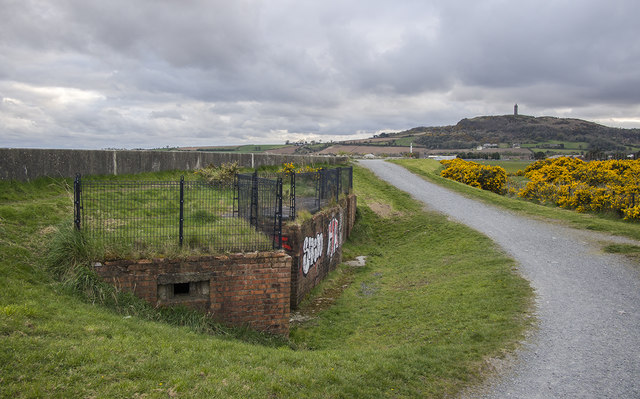
Pillbox, Newtownards
Old pillbox at Newtownards, now partially covered by the defensive sea wall to the left. The airport is to the right and Scrabo Tower is in the distance.
Newtownards Airport
The aerodrome at Newtownards opened as Ards Airport in 1934. It was used by the RAF for training during WWII and was bombed by the Luftwaffe in 1941. After WWII it reverted to its role as a civil airport. It is now owned by the Ulster Flying Club Link.
Loading map... (JavaScript required)
- Grid Square
- J4972, 81 images (more nearby 🔍)
- Photographer
- Rossographer (more nearby)
- Date Taken
- Sunday, 24 April, 2016 (more nearby)
- Submitted
- Monday, 25 April, 2016
- Subject Location
-
Irish:
 J 498 729 [100m precision]
WGS84: 54:34.9668N 5:40.9886W - Camera Location
-
Irish: J 498 729
- View Direction
- West-southwest (about 247 degrees)