2016
SP2755 : Gauge Board on the Footpath
taken 8 years ago, near to Wellesbourne, Warwickshire, England
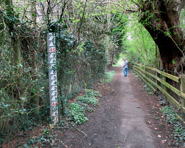
Gauge Board on the Footpath
This path is beside the River Dene and floods from time to time, as in SP2755 : Flooded footpath
 Map © Crown Copyright")
TIP: Click the map for more Large scale mapping
- Grid Square
- SP2755, 181 images (more nearby 🔍)
- Photographer
- Des Blenkinsopp (more nearby)
- Date Taken
- Thursday, 28 April, 2016 (more nearby)
- Submitted
- Saturday, 30 April, 2016
- Subject Location
-
OSGB36:
 SP 2766 5537 [10m precision]
WGS84: 52:11.7526N 1:35.8050W - Camera Location
-
OSGB36: SP 2768 5534
- View Direction
- North-northwest (about 337 degrees)