2016
SJ9534 : Old track at Hilderstone
taken 8 years ago, near to Hilderstone, Staffordshire, England
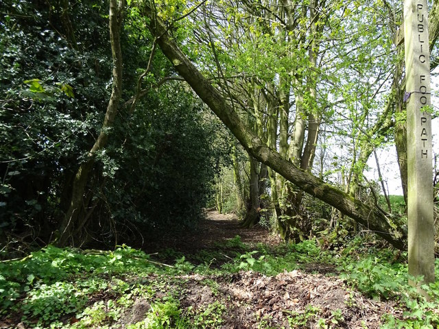
Old track at Hilderstone
This old track appears on the 1856 Ordnance Survey map running somewhat further into the fields than it does now. What remains of it is now part of a public footpath.
 Map © Crown Copyright")
TIP: Click the map for more Large scale mapping
- Grid Square
- SJ9534, 8 images (more nearby 🔍)
- Photographer
- Ian Calderwood (more nearby)
- Date Taken
- Wednesday, 4 May, 2016 (more nearby)
- Submitted
- Wednesday, 4 May, 2016
- Subject Location
-
OSGB36:
 SJ 9506 3488 [10m precision]
WGS84: 52:54.6794N 2:4.4942W - Camera Location
-
OSGB36: SJ 9509 3486
- View Direction
- Northwest (about 315 degrees)