2016
SE2436 : Kirkstall Forge Station, Leeds
taken 8 years ago, near to Horsforth, Leeds, England
This is 1 of 51 images, with title Kirkstall Forge Station, Leeds in this square
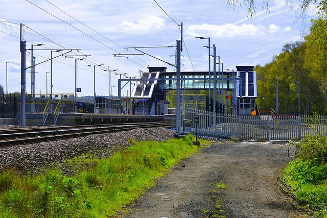
Kirkstall Forge Station, Leeds
A new railway station is being constructed on the Leeds to Shipley line at Kirkstall Forge. It will serve the planned development on the brownfield site at Kirsktall Forge, where there will be over 1,000 homes, plus commercial and leisure facilities.
Kirkstall Forge was probably the oldest industrial site in Britain. It was first developed as a mill by the monks of Kirkstall Abbey in the second half of the 12th century, and as a forge from the 16th century. By the end of the 20th century it was a large industrial site, mainly making truck axles. The forge closed in 2003, and the factory buildings were mostly cleared by 2005, ready for development. The development was put on hold during the recession, until late 2014.
The developers of the site are contributing to the construction of the station, which is the first development on the site. Initial work started in late 2014, and the station was planned to open in the summer of 2015. There were several unexplained delays, and the current plans are to open by Easter 2016.
Detailed planning permission has been given for the first commercial building on the site, construction should start during 2016.
See other images of Kirkstall Forge Station in development, Leeds to Shipley line
 Map © Crown Copyright")
TIP: Click the map for more Large scale mapping
- Grid Square
- SE2436, 563 images (more nearby 🔍)
- Photographer
- Mark Stevenson (more nearby)
- Date Taken
- Wednesday, 4 May, 2016 (more nearby)
- Submitted
- Thursday, 5 May, 2016
- Subject Location
-
OSGB36:
 SE 2479 3652 [10m precision]
WGS84: 53:49.4618N 1:37.4933W - Camera Location
-
OSGB36: SE 2476 3654
- View Direction
- East-southeast (about 112 degrees)