2016
NS3978 : Stirling Road
taken 8 years ago, near to Bonhill, West Dunbartonshire, Scotland
This is 1 of 2 images, with title Stirling Road in this square
Stirling Road
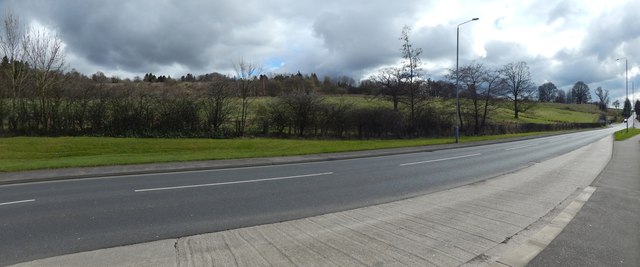
The picture was taken beside a bus stop. As the map shows, Strathleven Estate is on the near side of the road.
When this picture was taken, an application to develop the land on the other side of the road had recently been submitted; the present picture will serve for comparison with others taken after work began. That area is better seen in a view from the hedge on the other side of the road: NS3978 : Land opposite Strathleven Estate.
A sign that had appeared here by July 2016 gives "Mill Fields" as the name of the development.
Mill Fields
A new residential development in what was, until then, a field on the eastern side of Stirling Road, opposite the Strathleven housing estate. Construction began in mid-2016.
 Map © Crown Copyright")
TIP: Click the map for more Large scale mapping
- Grid Square
- NS3978, 192 images (more nearby 🔍)
- Photographer
- Lairich Rig (more nearby)
- Date Taken
- Wednesday, 30 March, 2016 (more nearby)
- Submitted
- Saturday, 7 May, 2016
- Subject Location
-
OSGB36:
 NS 3996 7851 [10m precision]
WGS84: 55:58.3696N 4:33.9654W - Camera Location
-
OSGB36: NS 3991 7854
- View Direction
- East-southeast (about 112 degrees)