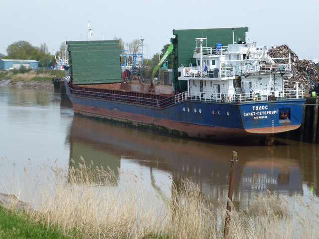
TF4510 : Loading scrap metal in Wisbech docks
taken 8 years ago, near to Wisbech, Cambridgeshire, England
One of the earliest mapped courses of the River Nene, from Peterborough to The Wash, was around Whittlesey Mere, through Benwick, March and Upwell, eventually joining The Well Stream at Outwell which flowed to the then coastal town of Wisbech. Over the centuries a straight channel was dug through the marshes north of Wisbech to the current outfall north of Sutton Bridge and the land on either side reclaimed. There are numerous visible sections of the old coastal banks on both sides of the River Nene north of Wisbech, see Link.
One of the earliest attempts to improve the flow of water from Peterborough to the coast and reduce flooding in the Fens was made by Bishop Morton who had a straight channel dug in the late 15th century from Peterborough to Wisbech known as Mortons Leam, see Link In the early 1700s a new and much larger straight channel was dug from Peterborough to Wisbech called Smith's Leam, parallel to and just north of Mortons Leam, to improve the flow of water from Peterborough to the sea. Mortons Leam from Guyhirn to Wisbech was incorporated into Smiths Leam and the remainder of Mortons Leam from Peterborough to Guyhirn became the main artery into and out of the Nene Washes which were created between Guyhirn and Peterborough.
Smiths Leam is now known as the River Nene and the original meandering river from Peterborough to Marmont Priory Lock in Upwell is now known as The River Nene (Old course), see Link.
 Map © Crown Copyright")
- Grid Square
- TF4510, 132 images (more nearby 🔍)
- Photographer
- Richard Humphrey (more nearby)
- Date Taken
- Friday, 6 May, 2016 (more nearby)
- Submitted
- Tuesday, 10 May, 2016
- Subject Location
-
OSGB36:
 TF 4565 1095 [10m precision]
WGS84: 52:40.6009N 0:9.1729E - Camera Location
-
OSGB36: TF 4558 1090
- View Direction
- East-northeast (about 67 degrees)