2016
SK5122 : Bridge 42A on the Soar Navigation
taken 8 years ago, near to Normanton on Soar, Nottinghamshire, England
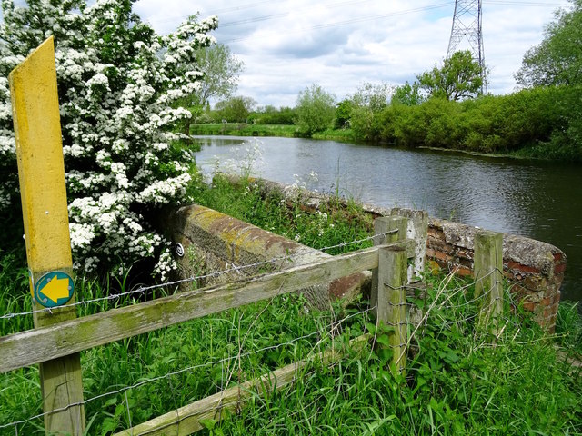
Bridge 42A on the Soar Navigation
This old footbridge is now disused and the path is diverted to a nearby farm crossing. The small plaque above the arch reads "42A".
 Map © Crown Copyright")
TIP: Click the map for more Large scale mapping
- Grid Square
- SK5122, 123 images (more nearby 🔍)
- Photographer
- Ian Calderwood (more nearby)
- Date Taken
- Tuesday, 24 May, 2016 (more nearby)
- Submitted
- Tuesday, 24 May, 2016
- Subject Location
-
OSGB36:
 SK 5196 2226 [10m precision]
WGS84: 52:47.7246N 1:13.8509W - Camera Location
-
OSGB36: SK 5196 2225
- View Direction
- North-northeast (about 22 degrees)