SJ8055 : Alsager: start of the Merelake Way
taken 8 years ago, near to Alsager, Cheshire East, England
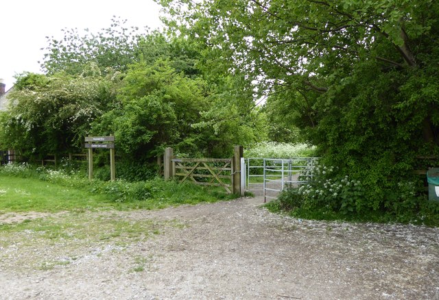
The Merelake Way is an approximately 1 mile / 1.5 kms long trail for walkers, located on the southern edge of Alsager. It follows the track bed of the former Alsager to Keele railway line, following a wooded cutting as it climbs uphill towards the Staffordshire border at Merelake.
See also The Audley branch railway Link .
The 'Audley branch', between Alsager Junction and Keele, closed to passenger traffic in April 1931, and to all traffic in January 1963. The section between Alsager and Merelake has been designated the 'Merelake Way', and is managed by Cheshire East Council. The stretch between Bignall End and Halmer End is a popular walking and dog-exercising route, and is always referred to locally as 'the lines'.
An account of the line's history is at Link.
 Map © Crown Copyright")
- Grid Square
- SJ8055, 62 images (more nearby 🔍)
- Photographer
- Jonathan Hutchins (more nearby)
- Date Taken
- Saturday, 28 May, 2016 (more nearby)
- Submitted
- Saturday, 28 May, 2016
- Subject Location
-
OSGB36:
 SJ 8070 5504 [10m precision]
WGS84: 53:5.5330N 2:17.3787W - Camera Location
-
OSGB36: SJ 80697 55059
- View Direction
- South-southeast (about 157 degrees)