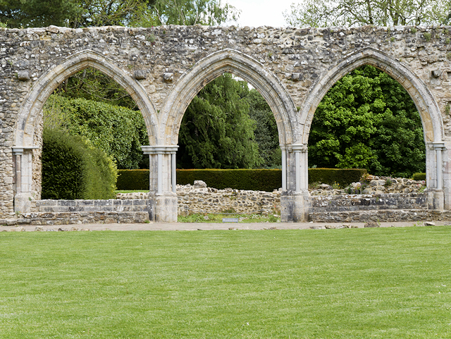
SU3802 : Beaulieu Abbey, Chapter House Arches
taken 8 years ago, near to Beaulieu, Hampshire, England
Beaulieu is a motor museum, house, and gardens set in the grounds of Palace House to the north of the village of Beaulieu.
The National Motor Museum Linkas it is known, is home to a large and varied collection of vehicles, including vintage and classic cars, motorbikes and commercial vehicles, land speed record cars, and racing and modern formula 1 cars. Next to the museum is 'World of Top Gear' with some of the cars featured in the BBC TV series Top Gear.
Palace house Link
Beaulieu Abbey Link
Around the site is a monorail which allows great views around the grounds, gardens, and even travels at high level through the motor museum between two stations.
Official website Link
 Map © Crown Copyright")
- Grid Square
- SU3802, 661 images (more nearby 🔍)
- Photographer
- David Dixon (more nearby)
- Date Taken
- Tuesday, 24 May, 2016 (more nearby)
- Submitted
- Monday, 30 May, 2016
- Subject Location
-
OSGB36:
 SU 388 025 [100m precision]
WGS84: 50:49.2934N 1:26.9987W - Camera Location
-
OSGB36: SU 388 025
- View Direction
- EAST (about 90 degrees)