2016

SU3802 : Beaulieu Mill Pond and Dam

taken 8 years ago, near to Beaulieu, Hampshire, England
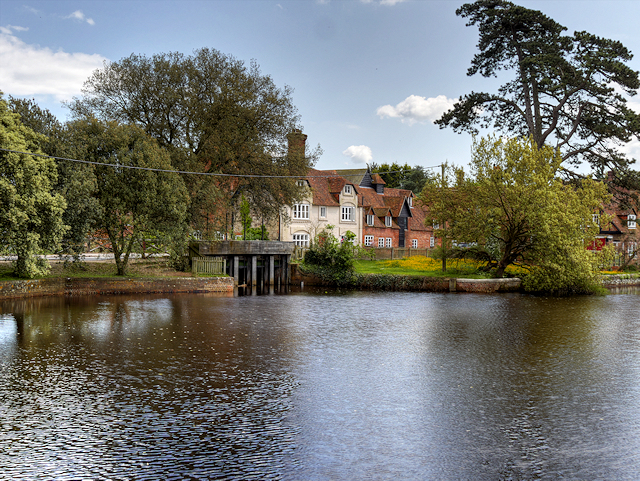
Beaulieu Mill Pond and Dam
The mill pond was created by the monks of Beaulieu Abbey in the thirteenth century, when they built a dam across the Beaulieu River to power their corn mill. Today, recently restored sluice gates control the level of water in the pond.
Beaulieu

Beaulieu is a motor museum, house, and gardens set in the grounds of Palace House to the north of the village of Beaulieu.

The National Motor Museum LinkExternal link as it is known, is home to a large and varied collection of vehicles, including vintage and classic cars, motorbikes and commercial vehicles, land speed record cars, and racing and modern formula 1 cars. Next to the museum is 'World of Top Gear' with some of the cars featured in the BBC TV series Top Gear.

Palace house LinkExternal link is a Grade I listed LinkExternal link 13th century house, which been the ancestral home of a branch of the Montagu family since 1538. The family still own and run the estate and museum.

Beaulieu Abbey LinkExternal link to the north-east of Palace House, is a Cistercian abbey, founded in 1204.

Around the site is a monorail which allows great views around the grounds, gardens, and even travels at high level through the motor museum between two stations.

Official website LinkExternal link


Creative Commons Licence [Some Rights Reserved]   © Copyright David Dixon and licensed for reuse under this Creative Commons Licence.
This photo is linked from: Automatic Clusters: · Beaulieu River [40] · Mill Dam [22] · Mill Pond [19] ·
1:50,000 Modern Day Landranger(TM) Map © Crown Copyright
+
+
1:50,000 Modern Day Landranger(TM) Map © Crown Copyright
TIP: Click the map for more Large scale mapping
Grid Square
SU3802, 661 images   (more nearby 🔍)
Photographer
David Dixon   (more nearby)
Date Taken
Tuesday, 24 May, 2016   (more nearby)
Submitted
Monday, 30 May, 2016
Subject Location
OSGB36: geotagged! SU 387 023 [100m precision]
WGS84: 50:49.1427N 1:27.0857W
Camera Location
OSGB36: geotagged! SU 387 023
View Direction
South-southeast (about 157 degrees)
Clickable map
+
NW N NE
W Go E
SW S SE
Image Type (about): geograph 
This page has been viewed about 288 times
You are not logged in login | register