2016
TA1137 : Fairholme Double Bridge
taken 8 years ago, near to Wawne, East Riding of Yorkshire, England
This is 1 of 4 images, with title starting with Fairholme in this square
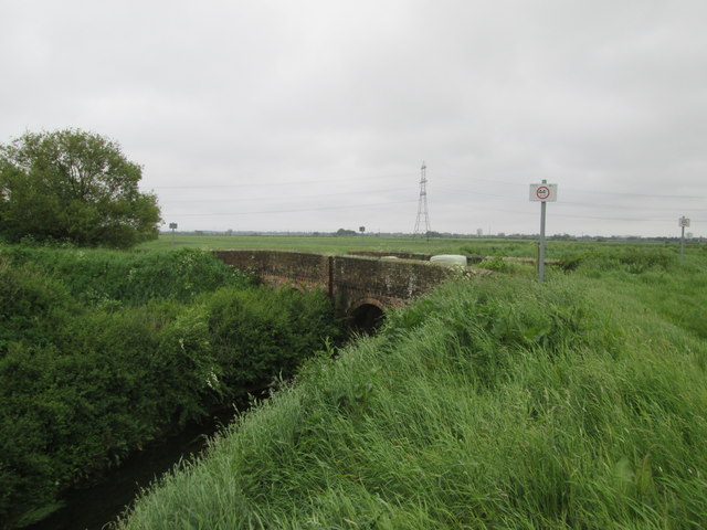
Fairholme Double Bridge
The nearest drain is Monkbridge Stream over the vegetation can be seen the second bridge arch which carries the water from Kelwell Drain. Once through the bridge the combined water becomes Fordyke Stream (Drain).
 Map © Crown Copyright")
TIP: Click the map for more Large scale mapping
- Grid Square
- TA1137, 21 images (more nearby 🔍)
- Photographer
- Martin Dawes (more nearby)
- Date Taken
- Wednesday, 1 June, 2016 (more nearby)
- Submitted
- Thursday, 2 June, 2016
- Subject Location
-
OSGB36:
 TA 1134 3730 [10m precision]
WGS84: 53:49.2037N 0:18.6109W - Camera Location
-
OSGB36: TA 1134 3732
- View Direction
- SOUTH (about 180 degrees)